UPDATE: 5:55 p.m.: A Tornado Watch remains in effect until 10 p.m. for Bates, Lafayette, Henry and Johnson counties in Missouri.
UPDATE: 5:45 p.m.: The National Weather Service has expired the Tornado Warning for northeastern Henry County and southern Pettis County in central Missouri.
UPDATE 4:50 p.m.: The National Weather Service’s Tornado Warning for northern Mercer County, Missouri has expired.
UPDATE: The National Weather Service has cancelled a Tornado Warning for southeastern Cass County.
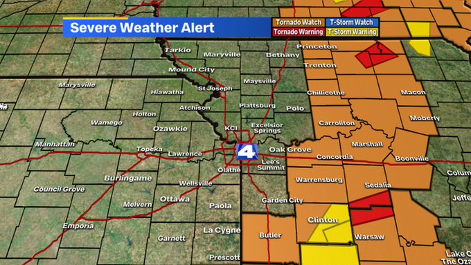
KANSAS CITY, Mo. — The National Weather Service has issued a Tornado Watch for the entire Kansas City area.
The Tornado Watch will be in effect until 10 p.m. for Johnson, Wyandotte Leavenworth, Franklin, Linn and Miami counties on the Kansas side and Jackson, Platte, Cass, Clay, Henry, Johnson, Clinton, Nodaway, Lafayette, Ray, Pettis, Caldwell, Dekalb, and Buchanan counties on the Missouri side.
During a tornado watch, conditions are favorable for a tornado to develop, but a tornado has not yet been sighted or indicated by weather radar.
A Severe Thunderstorm Watch has also been issued until 5 p.m. for Jackson, Lafeyette, Carroll and Ray counties in Missouri.
Severe storms are expected to move into the metro Tuesday afternoon, bringing high wind, hail and possibly some quick spin-up tornadoes.
The severe risk for Kansas City should end by 6 p.m. as the storms move east.
Storms should clear the viewing area by 7-8 PM this evening.
Suggest a Correction