The Houston region will likely see heavy rain, some flooding and tropical storm-force winds in the next 24 hours as Beryl continues to move toward the Texas coast.
City leaders urged residents to stay off the road starting at 10 p.m. Sunday.
“The less people on the road, the easier it is for us to do our job,” Acting Police Chief Larry Satterwhite said during a press conference Sunday. “The less chance that we will have to perform a rescue.”
“If you do have to go out on a roadway in a vehicle and drive around, if you see a body of water on the roadway, do not drive through that thinking you are going to get through that.”
RELATED: Houston Public Media Hurricane and Tropical Storm Tracker
Houston Mayor John Whitmire said county leaders and surrounding city leaders are prepared for Beryl to make its way north after it makes landfall on the Texas coast, potentially dropping six to 12 inches of rain in the area.
“I want Houstonians to know the conditions you go to sleep under tonight will not be the same that you wake up to in the morning,” Whitmire said.
Beryl is expected to enter the Houston area from the southwest region and counties like Fort Bend could see some of the strongest impacts of the storm.
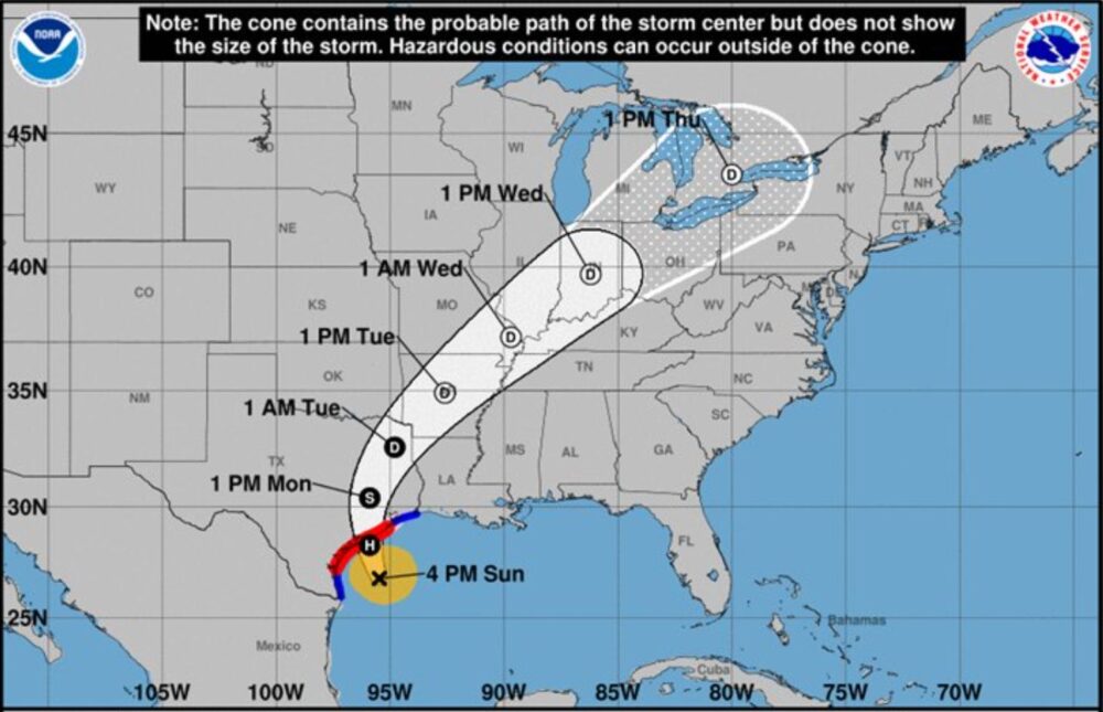
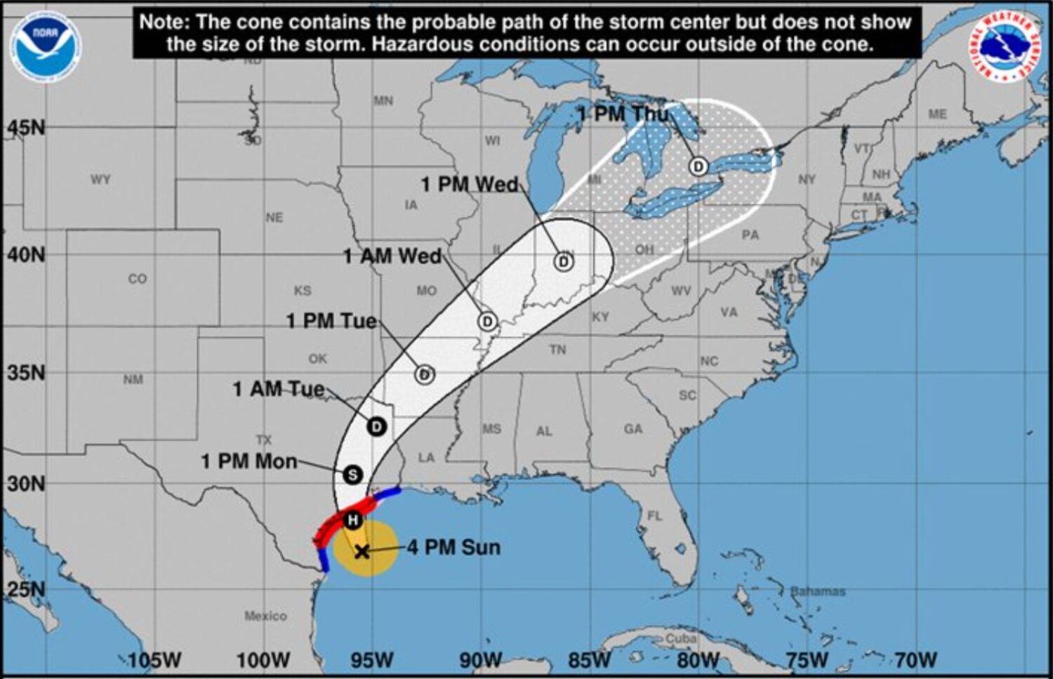
Updated tracking has expected landfall for the storm near Matagorda Bay early Monday morning.
If that track holds, the Houston region will see “some of the strongest winds and heaviest rains from Beryl,” according to Space City Weather’s Eric Berger.
Beryl was still a tropical storm as of Sunday afternoon, but is expected to make landfall Monday as a Category 1 hurricane.
Before landfall, the outer bands of the storm were already moving inland and parts of the Houston area were seeing on-and-off rain on Sunday morning.
“We’re seeing the outer bands of Beryl approach the Texas coast now and the weather should be going downhill especially this afternoon and evening,” Eric Blake, a senior hurricane specialist with the National Hurricane Center, said Sunday morning. “People should definitely be in their safe space by nightfall and we’re expecting the hurricane to make landfall somewhere in the middle Texas coast overnight.”

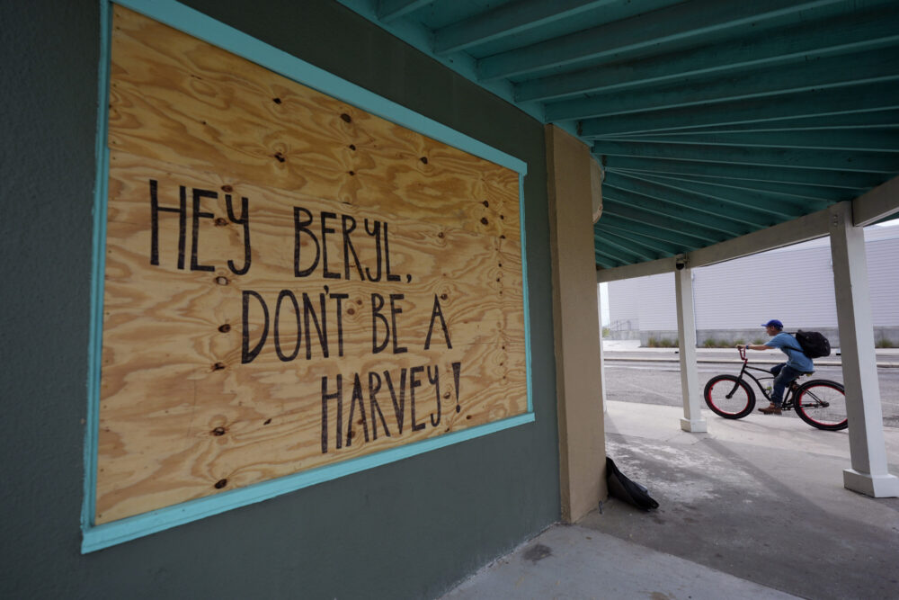
AP Photo/Eric Gay
Meteorologists are forecasting up to eight inches of rain for parts of the Houston region during the storm. Higher totals are likely to the south, with the potential for as much as 10 inches of rain in Galveston.
The heaviest rain is expected overnight and into Monday morning.
Meteorologist Bradley Brokamp, with the National Weather Service’s Houston-Galveston office, said residents should avoid unnecessary driving.
“Over the next several hours into tomorrow, we’re just gonna continue to see conditions deteriorate as Beryl continues to make its way towards our area,” Brokamp said. “Especially since this is going to be a Monday, if people are planning to be commuting to work they should be very careful because this is also kind of coinciding with the landfall timing.”
RELATED: LIST: Beryl triggers school, office closures across Houston region
Tropical storm level winds could be an issue for Galveston and the Houston region, with the potential for downed trees and power outages as a result. The heart of Houston could see winds at an estimated 35-55 mph during the storm.
Officials are warning of the potential for three to five feet of storm surge for Galveston. Galveston County on Saturday issued a preemptive disaster declaration.
A Hurricane Warning is in effect from Baffin Bay to San Luis Pass, Jackson County, Matagorda County and parts of Brazoria County. A Hurricane Watch is in effect for Galveston Island.
While the majority of flights from Bush Intercontinental and Hobby were leaving on time as of midday Sunday, more than 65 flights had been delayed and another four canceled, according to FlightAware data.
Fort Bend leaders prepare for Beryl
Fort Bend County has activated its emergency operations center ahead of Beryl.
“We expect to have a category one hurricane, but we are preparing at a level of category two,” County Judge KP George said during a Sunday afternoon press conference.
Officials are urging residents to finish hurricane preparations and stay off the roads during the storm. They also warned of tornadoes accompanying the storm.
The county saw threats of minor flooding from the Brazos River in May. But officials say those water levels have receded.
“We have a lot of capacity available in the Brazos River,” said Jeff Janecek, a first assistant engineer with the Fort Bend County Drainage District.
Statewide impacts expected
The White House said Sunday that the Federal Emergency Management Agency had sent emergency responders, search-and-rescue teams, bottled water, and other resources along the coast.
Some coastal cities called for voluntary evacuations in low-lying areas that are prone to flooding, banned beach camping and urged tourists traveling on the Fourth of July holiday weekend to move recreational vehicles from coastal parks. In Refugio County, north of Corpus Christi, officials issued a mandatory evacuation order for its 6,700 residents.
RELATED: Houston region prepares for heavy rains as Beryl approaches Texas coast
Lt. Gov. Dan Patrick, who is acting governor while Gov. Greg Abbott is traveling in Taiwan, issued a preemptive disaster declaration for 121 counties.
Beryl earlier this week battered Mexico as a Category 2 hurricane, toppling trees but causing no injuries or deaths before weakening to a tropical storm as it moved across the Yucatan Peninsula.
Beryl would be the 10th hurricane to hit Texas in July since 1851 and the fourth in the last 25 years, according to Colorado State University hurricane researcher Phil Klotzbach.
Dominic Anthony Walsh, Natalie Weber, Sarah Grunau and The Associated Press contributed to this report.


